
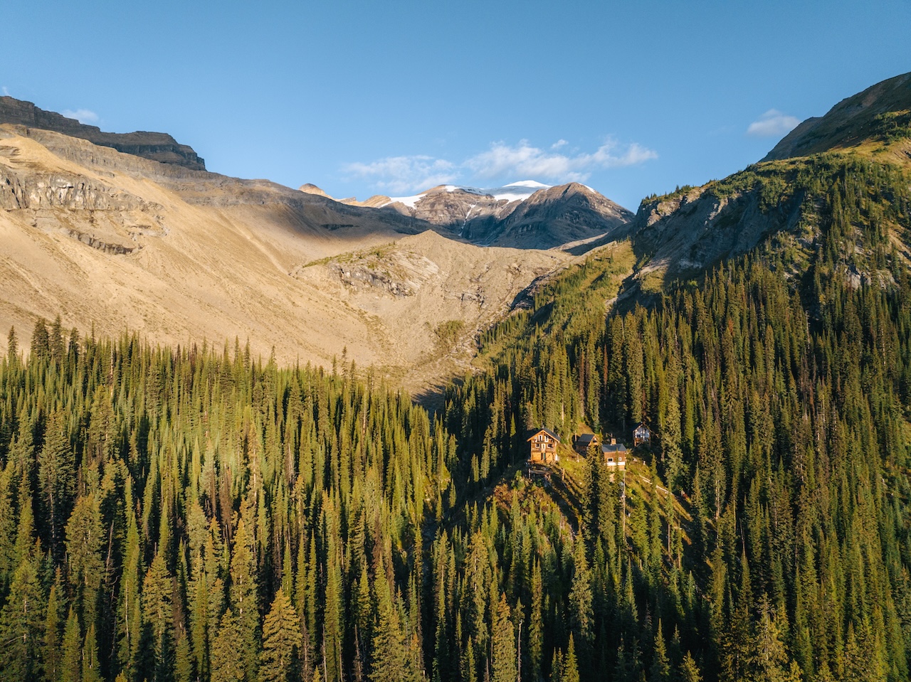
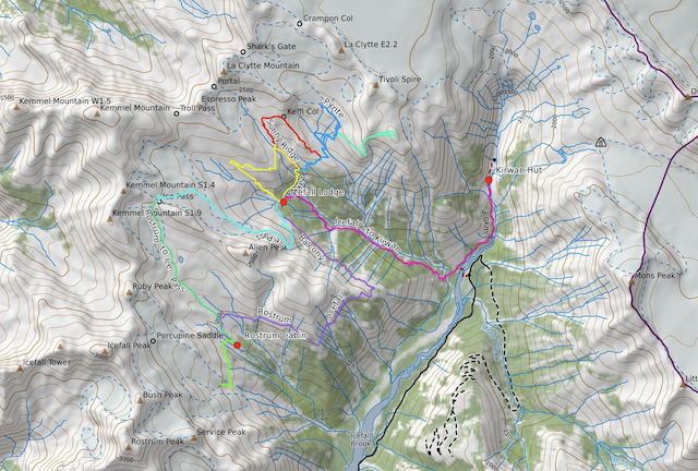
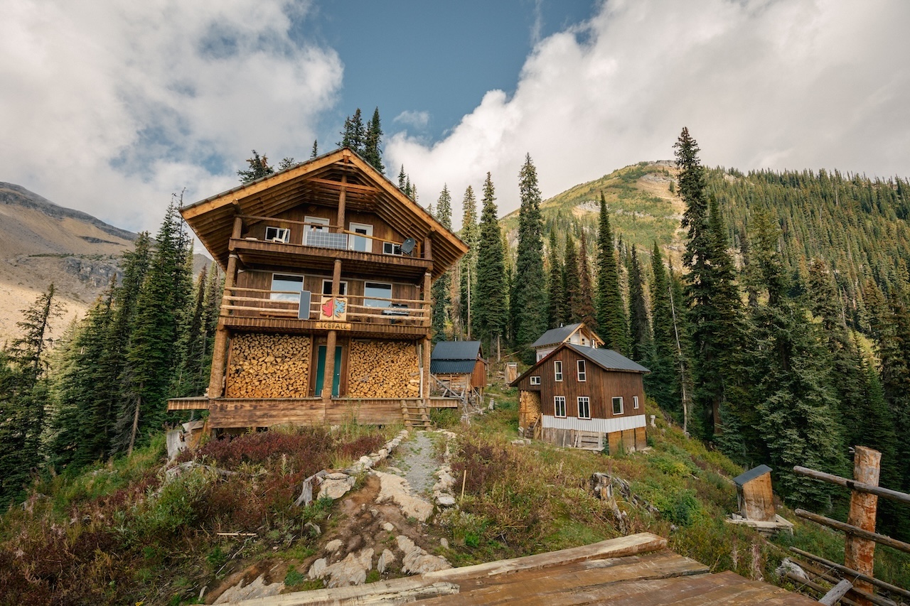
The Viewpoint
2
150
2
This trail is short and sweet, but the views do not disappoint.
Head north on the upper trail, which departs between the old lodge and the family cabin. The trail traverses through the forest and open slopes and then crosses Seduction Creek. On the other side of the creek, continue to follow the trail as it climbs and meanders in the forest. Look for the Viewpoint sign and head down a path on the right.
You know you have arrived when you find the bench overlooking the Valenciennes and Icefall Lodge.
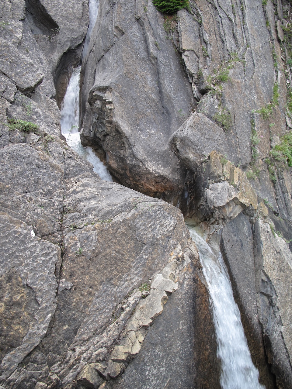
Honeymoon Canyon
2.5
200
2.5
This short trail follows the small creek that passes the lodge. Despite being small, it carves a unique canyon through the layer of limestone. There are many places to stop and view the waterfalls and canyons along the way. It can be done as a loop descending along the canyon to the bottom and then hiking back up to the lodge through open meadows.
It can also be done as an out-and-back by going down and then back up along the canyon.
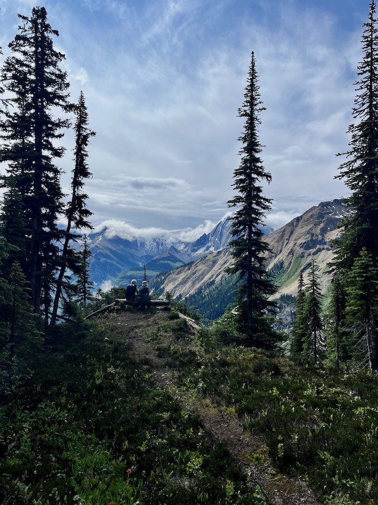
Espresso Ridge

5.5
480
5

This is the long, scenic ridge that rises directly behind the lodge. The trail takes a detour through alpine meadows and wildflowers before traversing back to the ridge. The high point is a lookout on the ridge at 2350m (7800 feet). From here, you can look down on the Lodge.
There are outstanding views of Mount Forbes, the highest peak in Banff National Park. From the lookout, the trail descends the opposite side through meadows and small streams, eventually traversing beneath the base of the ridge back to the lodge.
Another option is to continue up the bench on the west side of the ridge to Troll Pass. This high vantage point looks across at the glaciers and icefalls on the north face of Mt Kemmel. To the north, you can see the Columbia Icefields.
Sunny Ridge
6.5
500
6
The Sunny Ridge hike is a scenic loop to a treeline pass which looks across at the toe of the La Clytte Glacier. The path crosses several small streams and meadows, starting the same way as the Pyrite Lake Trail.
The trail branches off to the left and climbs a spectacular ridge to the saddle we call Keffi. There is one short, exposed section on this ridge; the rest is a broad, rounded ridge typically covered in wildflowers. Along this ridge, you’ll have views of the blue ice of the La Clytte Glacier to the east.
From the Keffi saddle, the route descends gradually to the meadows and loops back down.
For those concerned about the exposed section, you can do this trail as an out-and-back; simply turn around once you reach the exposed section on Sunny Ridge.
It is possible to extend this hike by linking it to the Espresso ridge loop. Once you cross Sunny Ridge, you can traverse the pass and connect to the Espresso Ridge Trail. This extension will make for an 8km loop (+660m).
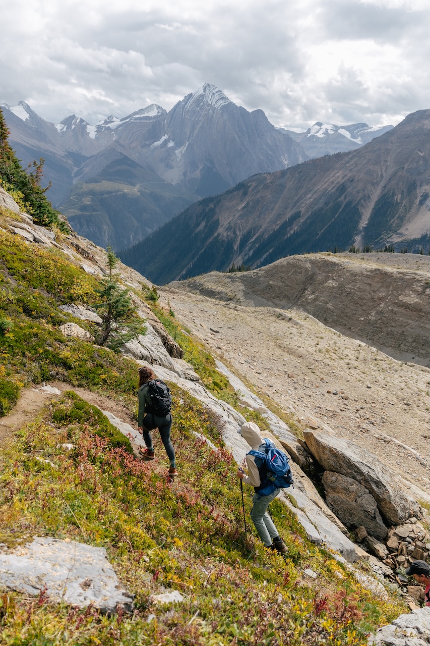
Ice Pass

9
600
7
This trail departs from the back of the lodge and heads south towards Alien Bowl. It gains elevation through boulders and meadows toward Alien bowl and then cuts back to gain the rocky ledges from which you get a bird’s eye view of Icefall Lodge, Espresso ridge, Sunny ridge, the LaClytte glacier and more.
Once above the ledges, the trail follows a long bench made up of rock slabs; flat and carved almost perfectly smooth by the glacier. Follow the cairns all the way to the back of the bowl until you reach Ice Pass. At the pass, there is a spectacular view of the Rostrum Valley.
Ice Pass makes for a good lunch spot/turnaround point.
*Ice Pass is halfway between Icefall Lodge and the Rostrum Cabin.
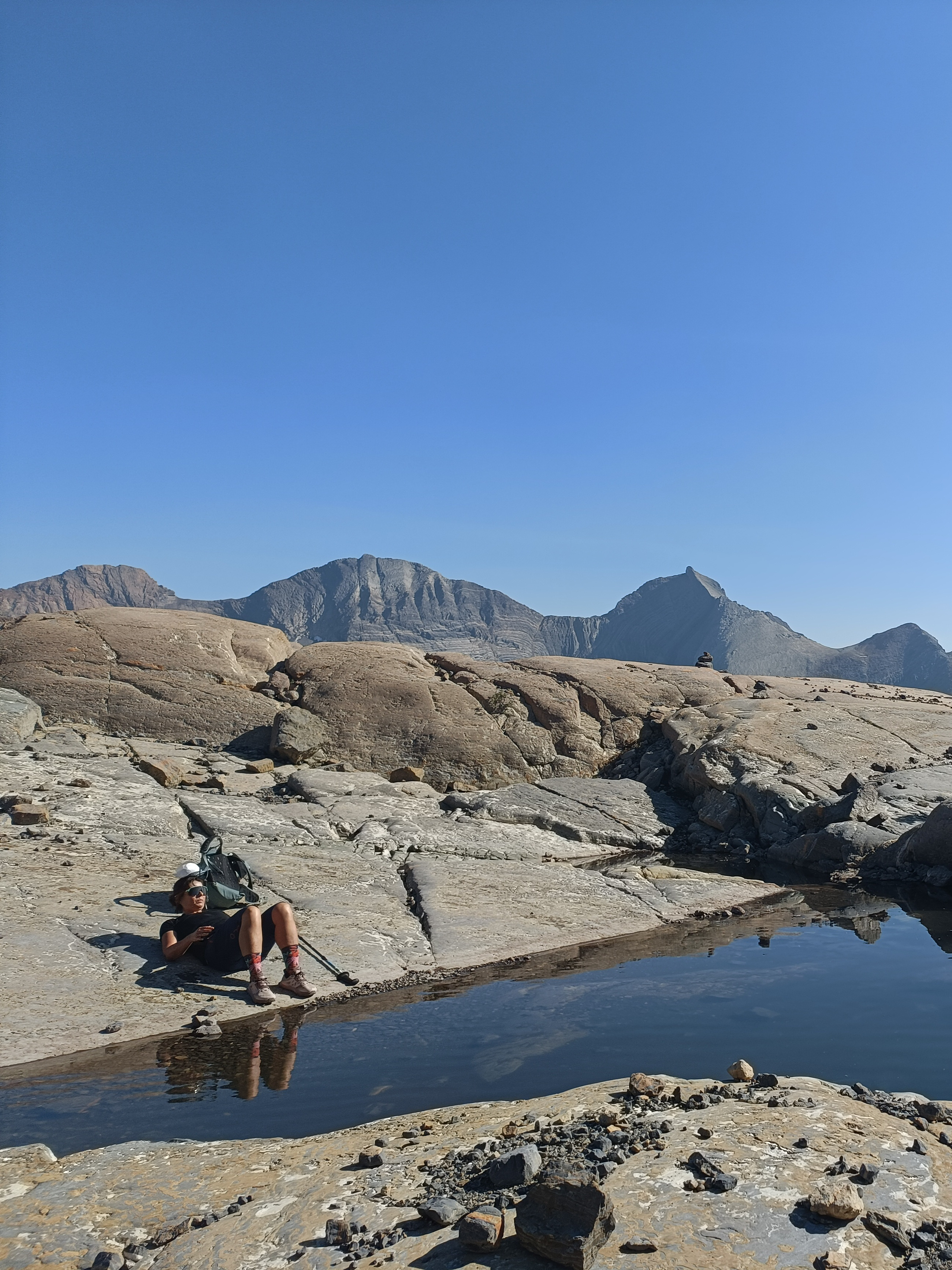
Pyrite Lake (currently Tivoli)


8
500
6
Luna Peak is the prominent rock buttress that can be seen when looking northeast from the front deck of Icefall Lodge. The trail to Pyrite Lake contours through forests, meadows and crosses several streams and eventually leads to a flat viewpoint directly across from this 300m cliff.
The trail then descends through wide rock ledges toward the La Clytte stream and crosses it. On the other side, the trail ascends to the looker’s right of the streams coming down from the glacier above and eventually reaches a plateau and a Y junction (2,250m).
The left branch traverses the rocky flats and glacial moraines and makes its way to Pyrite Lake which is the toe of the La Clytte glacier (2,350m) which offers stunning views and is a beautiful spot for lunch and a little rest.
Luna Peak (via White Lines)
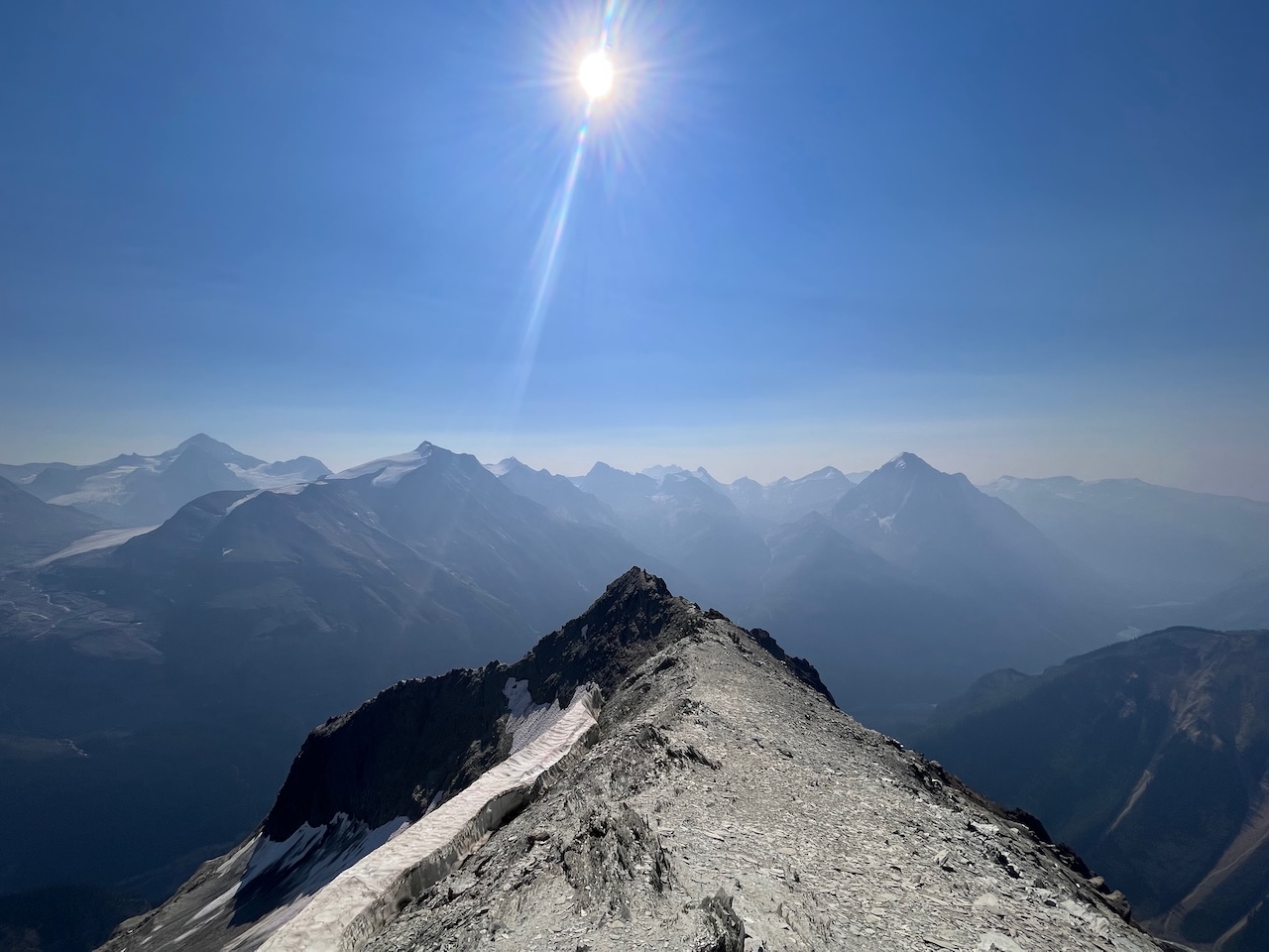
10
750
8
The trail to Luna Peak starts off the same way as the trail to Pyrite Lake. At the Y junction, take the right branch (White Lines), which follows a band of white rock to the ridge, and then up the ridge to a rocky outcrop.
The last 150m to the summit of Luna Peak (2,700m) consists of a scramble. Luna Peak offers a 360-degree panorama, looking down on the lodge, the La Clyttle Glacier and across at the Mons and Lyell Glaciers.
This is also the approach to the Lyell Hut. Despite being such a high peak surrounded by rugged glaciers, this hike is non-technical but can feel somewhat exposed in places.
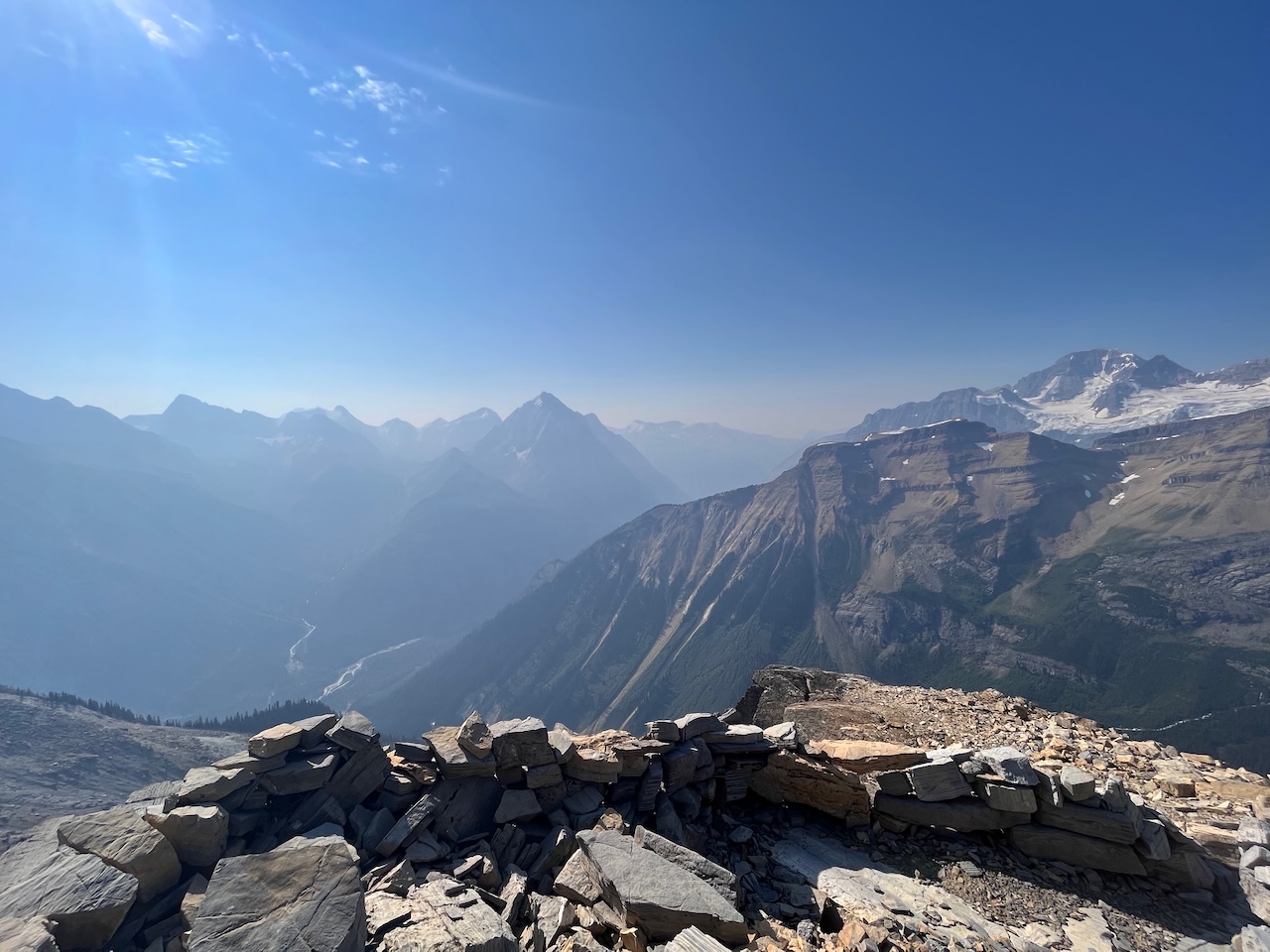
Rostrum Trail (frontside) via the Balcony


16
500
9
This trail traverses above Kemmel Valley at treeline, offering spectacular views of the Lyell Glacier and Division Peak to the east. This first part of the trail traverses to a lookout we affectionately call the Balcony. It’s a wonderful lunch spot with spectacular views of Mt. Arras. Turning around here can be a good day trip option.
If you continue on, once you wrap around the balcony, there is a unique perspective with a view into the Icefall Canyon to the east, the high, massive face of Rostrum Peak with its tumbling glaciers and seracs to the west and the curving couloirs of Mt. Arras straight ahead.
The trail then wraps around the ridge and enters the Rostrum Valley, leading to the Rostrum Cabin.
Icefall Canyon


3
50
1
This is truly one of the most spectacular hikes anywhere.
The Lyell and Mons Icefields, which cover over 50 square km, send glaciers down to the rim of this canyon. Waterfalls, up to 600m high, spill over from all sides of the canyon and even from the rock.
This trail starts from the Kirwan cabin at the valley bottom and follows Icefall Brook and sheer limestone walls all the way to the back of the horseshoe-shaped canyon. Along the way, countless waterfalls and caves will emerge from the walls, and when you reach the back and stand below the waterfalls, you will be in awe at the pure, untamed power of nature.
200 square km of beautiful hiking and alpine terrain
Contact Us!
Send us an email; we'd be happy to answer any questions you might have. If you would like to make a booking at one of our lodges, first check out our availability calendar, then head over to the booking page and fill out your trip request in the form there!
Availability
